Where should we look first?
Narrow a broad watch or warning to places that warrant closer review, so the team can focus its next readiness discussion.


USE CASES / EMERGENCITY AI
Two documented operational tests show how the Resilitix team used EmergenCITY AI to investigate potential exposure as threats approached. The hurricane example also includes team-supported screening after impact. Explore the questions, assessments, and retrospective reviews—and the planning discussions and local checks this work can inform. Human teams retain responsibility for decisions.
Real event conditions. Documented briefs. A clear view of what the screening showed—and what the review could establish.
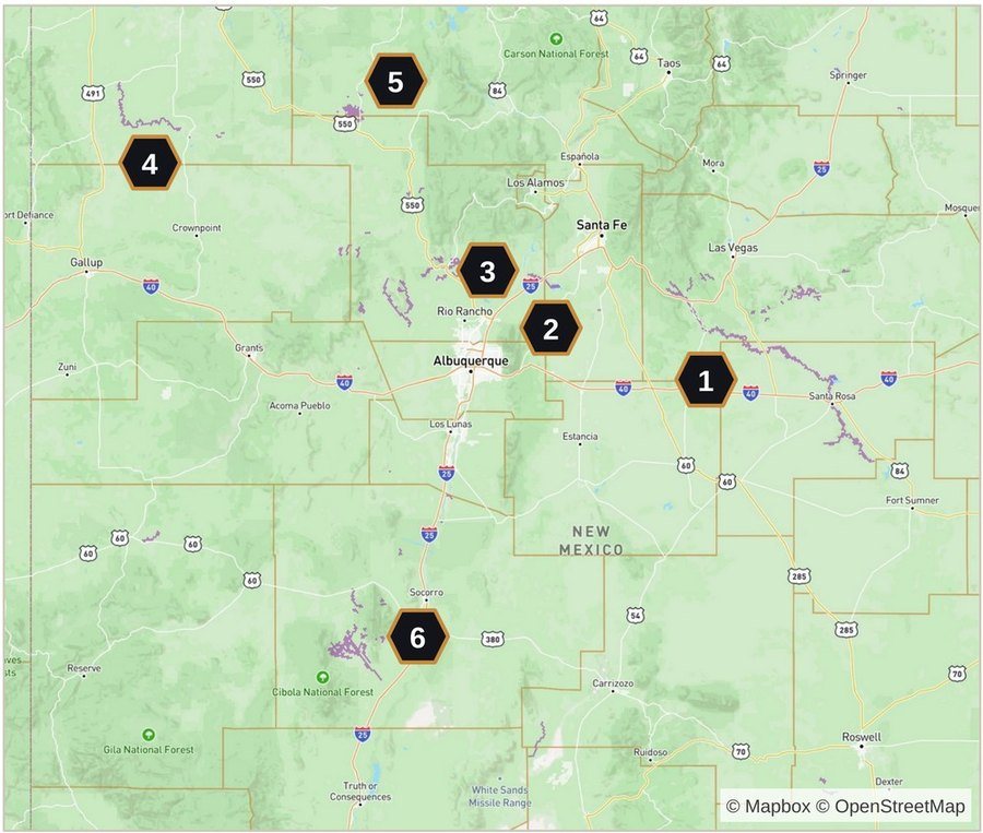
Where to look first
As a threat approaches
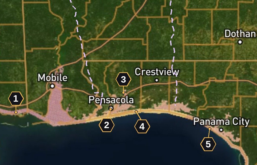
From regional warnings to local priorities
As a threat approaches · After impact
After-impact screening was team-supported.
The figures above describe brief preparation and screening scope. Each case study separately reports retrospective findings and their limitations.
Narrow a broad watch or warning to places that warrant closer review, so the team can focus its next readiness discussion.
Connect hazard signals with people, structures, and essential services to identify questions for local verification.
Revisit the assessment as suitable evidence changes, then examine what it means for the next planning question.
Review the sources and assumptions behind a finding, identify gaps, and define the next local check or specialist question.
Explore how these questions were addressed in the flood and hurricane case studies above.
In these tests, the Resilitix team examined hazard and exposure layers, compared supporting signals and official alerts, and prepared briefs as the evidence changed. After the events, the team compared earlier screening with reported impacts. Each step made the findings, remaining questions, and basis for further review more explicit.
Ask focused questions about forecast river flows, modeled flood events, surge, outage potential, residents and structures.
Compare hazard and exposure layers, look for corroborating signals, and avoid double-counting overlapping flood cells.
Build a short list for attention and local verification using official alerts, exposure and the evidence available.
Prepare a concise briefing that shows the priorities, supporting evidence and known gaps. Refresh it as advisories change.
After the event, compare the earlier briefs with reported impacts. State the matching rules and limits alongside the findings.
Resilitix ran the screens and prepared the briefs for emergency-management users. These were operational tests; partner decisions and resulting outcomes were not assessed.
Forecast and modeled exposure maps show where impacts could occur. Post-event maps show reported impacts compiled from news, official sources and NWS products. The captions identify which kind of evidence you are seeing.
The review figures describe reported impacts within areas flagged beforehand; they do not establish predictive accuracy or operational decision outcomes, and non-impacted flagged areas and false-alarm burden were not assessed. Method and impact lists are available on request.
Figures are linked to dated runs, brief completion records or the team’s post-event review. Completion times describe when a brief was prepared; they do not document when a partner received or acted on it.
Start with the area you cover, the question you need to answer, and the planning task the assessment should help advance. Explore a scoped operational test with the Resilitix team.
Opens your email app · info@resilitix.ai
EmergenCITY AI is designed for screening-grade resilience intelligence, planning, preparedness, monitoring, and decision support. It does not replace official forecasts, emergency command decisions, engineering studies, regulatory determinations, or local expert judgment.
The system runs the first pass. Your team makes the call. Resilience intelligence on demand.
emergencity.ai · info@resilitix.ai · EmergenCITY AI · Geospatial Resilience Intelligence